


Journeying Back in Time Through Maps

Centuries before the air plane was invented and the world was much larger than it seems now, Western travelers tried in their own ways to explore the East and, as a gift back home, they often brought with them printed maps of the unforeseen cultures. Now, for the first time, a comprehensive collection of antique maps of China is available in a book authored by our HKUST scholar.
This will be the first and unique scholarly work in cartography.
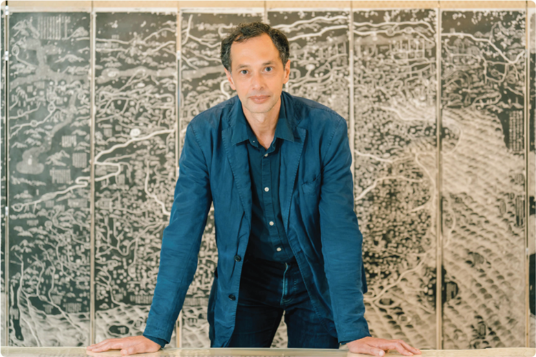
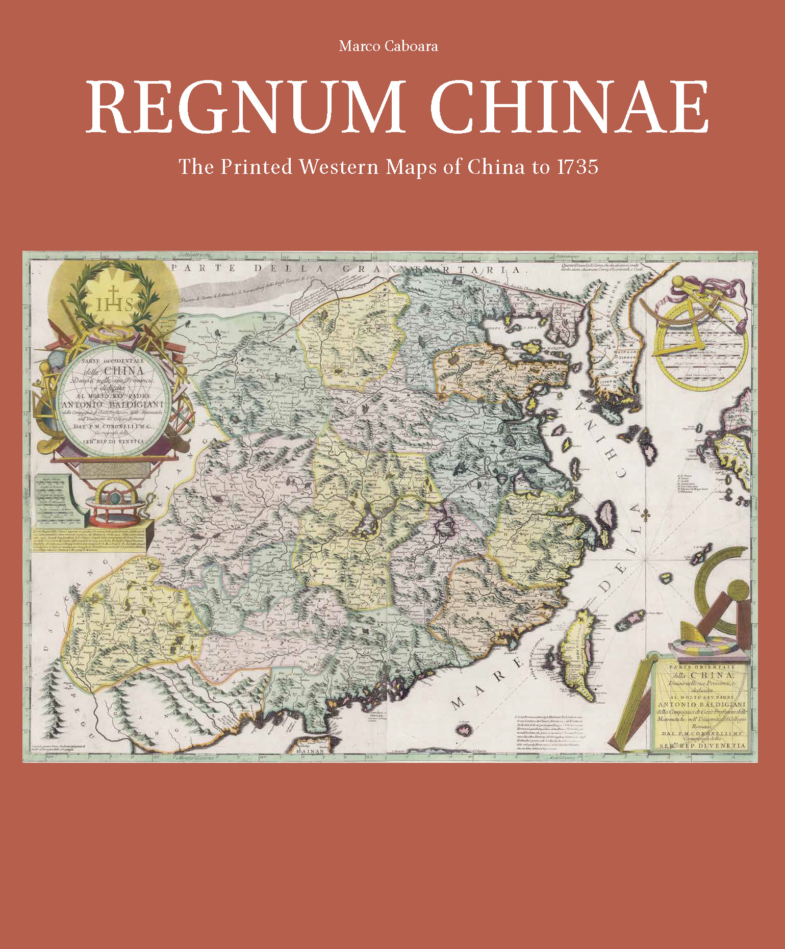
Titled “Regnum Chinae: The Printed Western Maps of China to 1735”, the book features 127 Western printed maps of China from 1584 to 1735, which has taken Dr. Marco CABOARA, Digital Scholarship and Archives Manager at HKUST Lee Shau Kee Library, and his team four years to finish.
“This will be the first and unique scholarly work in cartography, where currently no such title exists in English or Chinese,” says Dr. Caboara.
The book is one of the highlights of HKUST’s Western Maps of China Project, which started 10 years ago when the Library acquired a large collection of antique maps of China. With the generous funding from Dr. Winnie KO Pui Shuen, an HKUST Honorary Fellow, the collection was digitized, and the team went on to turn it to a book.
Treasure hunts around the world
While most of the maps are already at the Library, Dr. Caboara still had to journey around the world to acquire more maps to complete the collection.
“I didn’t just go to national libraries or big galleries, but got in touch with map collectors and dealers in Germany, Italy and the Netherlands to view the maps. The owners were very, very friendly and eager to share the many interesting stories behind. It was like I was joining a small, sacred society of map maniacs,” says Dr. Caboara.
In the end, the book is not just about reprinting maps but also writing history and stories.
He would either purchase the original maps or request owners’ permission to reproduce images of the maps to be featured in the book. The team eventually came across a total of 127 maps.
“In the end, the book is not just about reprinting maps but also writing history and stories,” says the author.
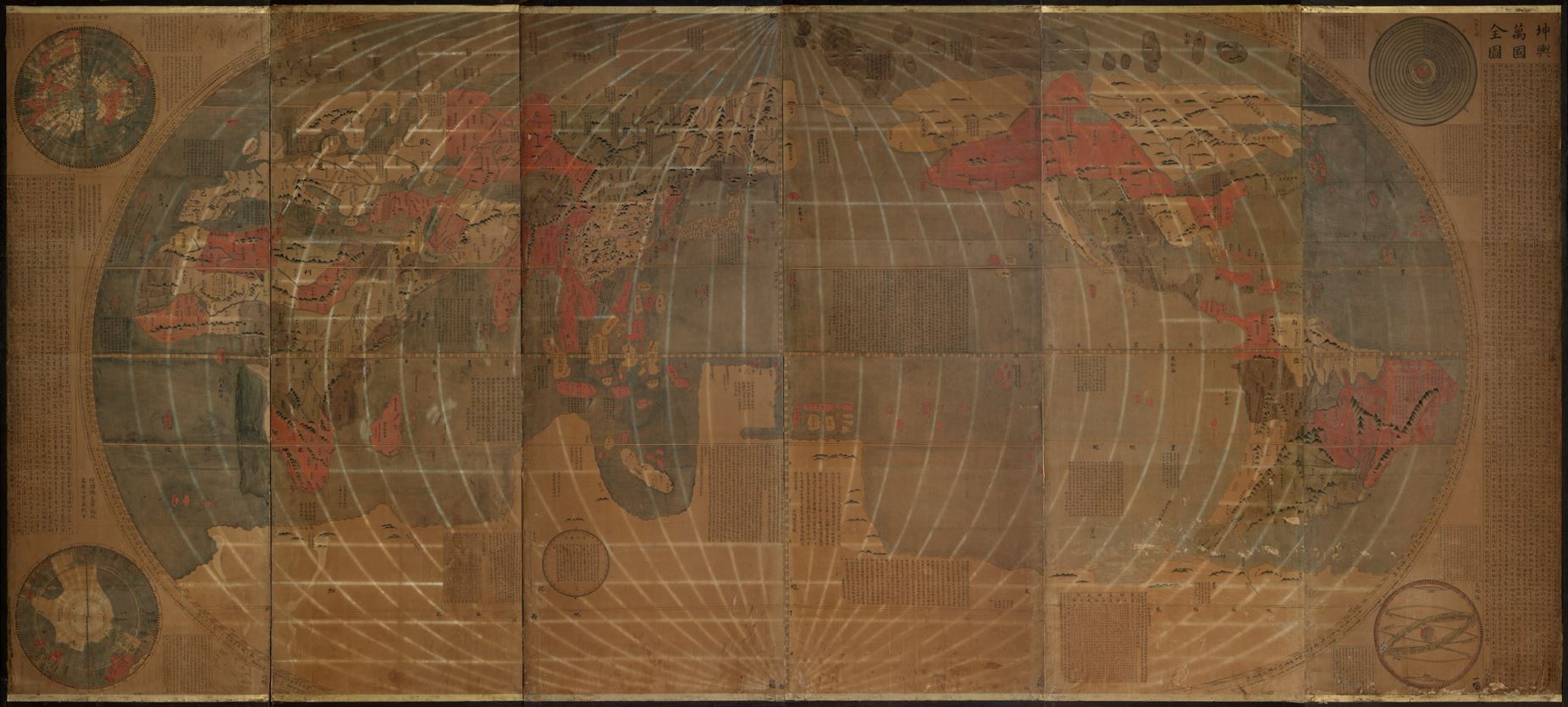
Of the maps featured in Regnum Chinae, Dr. Caboara considers there were two stand-out stars. The first one is a 3.8-meter-long giant creation called “Ricci World Map on a Japanese Screen”.
“It is the first known world map in Chinese and combines Eastern and Western science of making maps. The map is worth about US$200,000 and now stored in the vault of the Library,” says Dr. Caboara, adding that a safe and suitable display area is under progress at the Library. When it is done, this striking collection will be shown to public in a planned exhibition.
Another star map is “The Kingdom of China and its surrounding islands” created for the Jesuit, brotherhood of the Catholic Church.
“The map shows Chinese provinces, prefectures and districts with great details, which is stunning despite the lack of travel means at the time of its creation in 1590s. It was likely to be used for planning missionary work,” says Dr. Caboara.
There is one particular story that struck my imagination.
The book not only features extraordinarily rare and precious maps like the two above but those that have stories to tell, and one of them is more to the dark side.
“There is this special map published in 1640s in the Netherlands, which had the most advanced mapping techniques around the time. The publisher sent his son from Amsterdam to Frankfurt for a book fair to present the map. But unfortunately, the son was eaten by cannibals on the way to Frankfurt. This is certainly not my favorite story but one that struck my imagination.”
Despite the book being published for academic use, general readers will find the stories and the richness of aesthetic values captivating.
“You see beautiful images like ancient Chinese ladies and gentlemen, sea monsters depicting danger zones, and castles representing cities. You also see Macao already appeared on the ancient maps, while Hong Kong was yet to be a significant place,” says Dr. Caboara.
Author’s Eastern journey
A historian and cultural scholar specializing in classical Chinese studies, Dr. Caboara first discovered his passion for Chinese literature and philosophy when he was a high school student back in his hometown Italy.
“I read Zhuang-zi (莊子) and The Dream of the Red Chamber (紅樓夢) in Italian, and found myself much attracted to the culture and ideas such as the “The Butterfly Dream” (莊周夢蝶),” recalls Dr. Caboara. Eager to explore one of the earliest ancient civilizations, the young man journeyed east after university graduation and stayed for six months in Beijing.
“My mother saw me off at the airport and thought she has lost her son for good,” laughs Dr. Caboara. “But I have always had this fascination about learning and discovering a civilization that is so different from ours. After I completed my PhD, I looked for opportunities to go back to China, and soon, I found myself in Hong Kong, teaching courses in many local universities, including one here at HKUST,” says Dr. Caboara.
“It has been a very refreshing experience. Many of my students are from the School of Science, Engineering and Business and Management, as part of the cross-discipline learning initiatives. Oftentimes the students are fascinated by the arts subjects taught by not a Chinese but a foreigner,” smiles Dr. Caboara.
With his “baby” – the book – coming out, Dr. Caboara describes it was one of the greatest achievements in his career.
“Now, I am publishing a strong reference book in the cartography field. Whenever people want to know more about the maps of China, they will refer to this book – I am very proud to leave my mark in the academic field,” says Dr. Caboara.
Regnum Chinae: The Printed Western Maps of China to 1735 is published in October 2022. An interactive website is also created by the Library for the general public to explore the maps and history of China. Check them out!
Sign Up for Our Latest News
Latest News

香港科技大學(科大)牽頭研製的全球首款輕小型、高分辨率、高精度二氧化碳(CO₂)與甲烷(CH₄)點源協同探測儀「天韻相機」(MUSICO)日前由香港首位載荷專家黎家盈博士及另外兩位航天員在軌組裝檢測,並成功安裝於中國「天宮」太空站外指定載荷掛點位置,正式投入運作。儀器將於未來兩年或更長時間提供自主、可控且具高精準度的二氧化碳與甲烷排放監測數據。相關成果將與政府部門及科研機構共享,為應對氣候變化及推動全球可持續發展作出貢獻。

A generous donation from one of Hong Kong’s leading entrepreneurs marks the first scholarship specifically designated for HKUST’s Major + AI program, reinforcing the University’s mission to nurture talent with an interdisciplinary mindset and the ability to integrate AI across disciplines to solve real-world challenges.
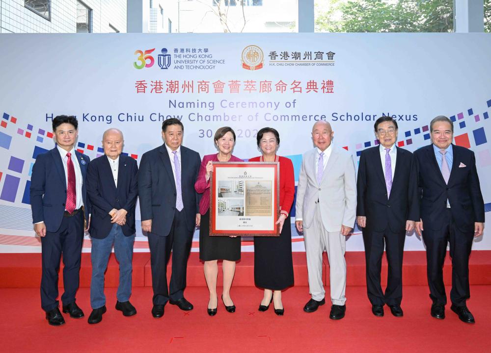
The Hong Kong University of Science and Technology (HKUST) has received a generous donation from the Hong Kong Chiu Chow Chamber of Commerce (The Chamber) to support the University’s academic development and research innovation. The donation will also establish a scholarship scheme to encourage HKUST students to explore their potential beyond academics, while promoting exchange of Chinese culture and technology.